
Empower Field Insights With Enhanced Imagery
How Agrian Empowers Farmer Field Insights With Enhanced Satellite Imagery
Precision ag is all about recognizing efficiencies. Whether it’s recognizing optimal irrigation to maximize water usage or ensuring crops get the perfect amount of fertilizer, the success of boosting the overall economics of the farm depends on the accuracy of the information you collect.
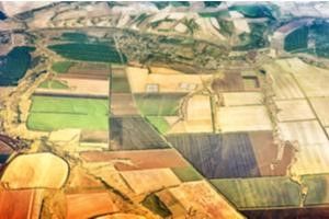
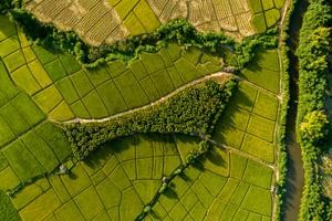
The same is true with imagery – quite literally, it’s hard to recognize anything if your satellite images aren’t clear. Good imagery gives farmers and consultants the ability to accurately detect trouble areas, view the effects of weather systems, and optimize scouting efforts in a much more targeted way.
Unfortunately, enhanced satellite imagery can be challenging to acquire. First, it’s expensive. “Traditionally it’s been difficult for farmers to justify the expense of imagery,” explained Peter Brandt, Chief Technology Officer, Agrian Inc..
Any infrared imagery or enhanced satellite imagery technologies developed to actually be used by farmers has to account for this expense. That’s exactly what Agrian’s 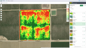 enhanced satellite imagery tools does: “As we built out Agrian’s precision toolbox for our user base, we specifically sought to tackle the challenge of expense, as well as other key challenges imagery has presented in the past.” Peter Brandt explained. Here’s how:
Making Imagery Affordable: Free Enhanced Satellite Imagery with Agrian
Agrian offers free enhanced satellite imagery to all subscribers. An Agrian user has access to imagery that captures up to two million square miles daily and provides access to high-resolution, multispectral (including infrared ir) in-season imagery. Those seeking even higher resolution can upgrade to TerrAvion imagery.
Making Imagery Useful: Enhanced Satellite Imagery Integration with Agrian
Expenses aren’t the only challenge facing farmers who want to make use of enhanced satellite imagery, however. Satellite imagery as an industry has changed a lot in the past 10 to 15 years. Unless you’re actively involved in the industry, it can be hard to keep up with everything you need to know to utilize satellite imagery effectively. It doesn’t matter how powerful your satellite imagery is if it isn’t useful!
Agrian continues to find ways to integrate enhanced satellite imagery seamlessly into our existing tools to make it more useful. Instead of simply providing the imagery, we provide the context and use-case for it. “The more accurate an image is, the more reliable it is in informing decisions,” said Brandt. “It’s also important that our imagery be customizable and as easy as possible to read and interpret. That’s what will make it valuable to our advisors and growers.”
The best way to make enhanced satellite imagery useful to advisors and growers is to use it as a starting point to build custom applications centered around what you actually need. Agrian developed the following features using satellite technology specifically for growers and advisors like you. Here are a few examples of the kinds of things Agrian’s enhanced satellite imagery can give you:
Making Imagery Easy: Agrian’s Enhanced Satellite Imagery Capabilities
Auto-atmospheric correction
This enhanced image processing tool is completely unique to Agrian. It was developed specifically to provide subscribers a better picture of what’s happening in their fields. The importance of having atmospherically-corrected data is found by eliminating the variable of ‘atmosphere.’
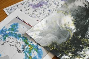
By automatically filtering out cloud tops, the temperature of the clouds (using infrared radiation), the weather forecast, and other selected atmospheric factors, this tool allows for a much more accurate comparison of the important aspects of two field images. “One way advisors use imagery is to compare the same thing in two different areas,” explained Nick Morrow, Vice President of Product Management, Agrian Inc. “For example, if I want to look at images from a cornfield in Iowa versus one in Minnesota, potentially collected with a different sensor, in different atmospheres, we can remove that variance in order to better compare.”
Morrow pointed out that correcting images in this way is also helpful when evaluating a single field or area over time. “Across any given month, season or year, the dust and water vapor particles in the air will change; you need to remove those in order to get an accurate representation of what the crop is doing. It’s like the difference between taking a picture of a house across the road on a sunny day compared to a foggy day. If you didn’t know any better, you would think the house had changed, but you are only seeing the effect of the atmosphere. Remove that, and you can see if the house really changed, and how.”
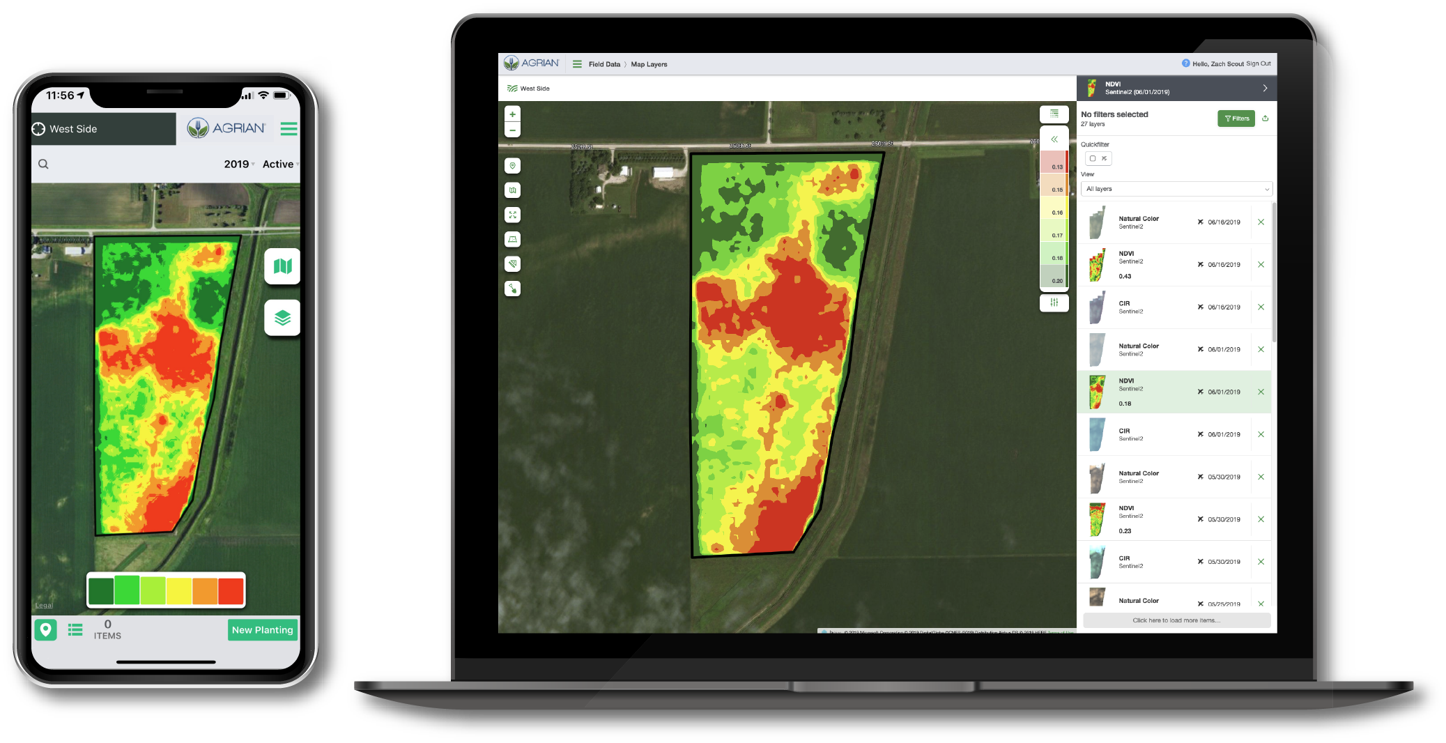
Map Layers allow analysis
The way users interact with imagery has also been made easier. Agrian’s enhanced satellite imagery processing system now eliminates all images of low quality, resulting in the most accurate imaging possible. Map Layers allows users to set up filters for what they want to view – such as date, layer type or imagery type, for quick analysis when making scouting, sampling, seeding prescription, or other agronomic management decisions.
Brandt believes the Map Layers feature can reveal patterns or insights that might not have been as easy to see before. “It’s not just an analytical tool, but also a discovery tool,” he explained. “Progressive images (or time lapses) are used to create a time series chart that shows how a crop is developing. On that chart, you want to see a smooth curve. If you’re using sub-par images, your crop development curve will be less accurate, more irregular, which makes it harder to interpret in order to make sound management decisions.”
Zonal statistical tools
For use along with the new map layers, Agrian has also upgraded its zonal statistical tools, making it faster and easier for users to draw conclusions from customized data sets.
“Users like our tools because it allows them to experiment,” said Morrow. “They enjoy ‘playing’ with map layers, making comparisons, and drawing correlations. We find advisors bringing new insights to growers based on their experience with the statistical tools applied to the images, and we also see growers using the tools to generate questions that they bring to their advisor. Analyzing imagery really gets conversations going between advisors and growers.”
Enhanced processing speed and accessibility
Although receiving imagery in real-time remains an as-yet unattained holy grail, image processing time has been shortened dramatically in recent years. Agrian’s system can consume imagery bands for both Sentinel 2 and Landsat 8 up to six times faster than it had previously. “We get images from satellites and some aerial providers, and within hours – sometimes minutes – make those imagery events available to our subscribers,” said Morrow.
Cloud computing, centralized processing, greater automation and improved imaging accuracy have all contributed to bringing Agrian users their images so quickly. “It wasn’t long ago that the computational power needed to do that would have made it infeasible. Now, a process that used to take a day or two is done next-day or within hours – and we’re processing more data than ever before,” added Morrow.
Offline access to imagery data
Despite all the advancements in technology, Brandt acknowledges that in the real-world, sometimes you need the ability to access your data offline. With Agrian’s native mobile app, images are available offline if users find themselves with spotty or degraded internet service.
“Imagery has been around a long time,” concludes Brandt, “Our goal has been to build an infrastructure that enables us to retrieve the highest possible volume of imagery at the drop of a hat, and, more importantly, make it quickly available and conveniently useful for our users.”
The best part of enhanced satellite imagery technology is that it’s still evolving all the time. Agrian is committed to remaining at the very forefront of that evolution – and ensuring that our subscribers can always benefit from it in affordable and useful ways.
If you’re interested in recognizing efficiencies with enhanced satellite imagery, get in touch with Agrian to schedule a demo or sign up today. Satellite imagery you can actually use isn’t as unattainable as you might think – not when you choose Agrian.